Proactive Fire Prevention with Technology
Proactive Fire Prevention with Technology
As the frequency and intensity of wildfires continue to increase, organizations are focusing on improving their fire safety plans. A critical component of these plans is the ability to predict and prevent fires before they cause extensive damage. One of the most effective ways to achieve this is by leveraging advanced technologies such as remote sensing, satellite imagery, and predictive analytics. In this post, we’ll explore how these technologies can help organizations identify fire-prone areas early, improve decision-making, and ultimately reduce the risk of wildfire incidents.
The Importance of Proactive Fire Prevention
While emergency response protocols are essential for mitigating the impact of fires once they start, proactive prevention is key to reducing their occurrence. Traditional fire safety strategies often rely on reactive measures, such as responding to fires once they’ve already been detected. However, a proactive approach allows companies to stay ahead of potential threats, minimizing risks and enabling faster responses.
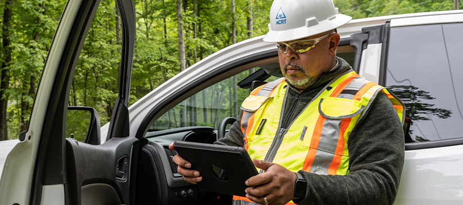
Technology plays a vital role in this proactive approach, providing real-time data and actionable insights. By integrating tools that allow for constant monitoring of environmental conditions and vegetation, organizations can pinpoint potential fire risks before they escalate into emergencies.
Know You’re Doing It Right
Get our UVM best practices overview now.
Technologies Revolutionizing Fire Risk Management
Remote Sensing
Remote sensing technologies, which involve the use of satellite imagery, drones, and airborne sensors, offer a bird’s-eye view of large landscapes, helping organizations assess vegetation conditions and environmental variables over vast areas. This technology can detect changes in moisture levels, temperature, and vegetation density — factors that contribute to the likelihood of wildfires.
For example, remote sensing can identify areas with high vegetation density or dried-out plant life, signaling potential fuel sources for fires. These insights can then be used to direct targeted fire prevention efforts, such as controlled burns or vegetation management.
Predictive Analytics
Predictive analytics uses historical data, weather forecasts, and environmental factors to model and forecast fire risks. By analyzing patterns such as past fire occurrences, drought conditions, and seasonal changes, organizations can predict where fires are most likely to occur. This technology not only helps prioritize areas for preventative action but also provides real-time decision support during fire events.
Predictive models can be customized to consider local conditions, such as topography and vegetation type, which vary across regions. These tailored models allow for more accurate predictions, ensuring resources are focused where they are most needed.
Key Benefits of Integrating Technology into Fire Safety Plans
- Early Detection and Risk Assessment: By monitoring environmental conditions continuously, organizations can detect risks before they escalate into wildfires, allowing for early intervention.
- Resource Optimization: Predictive analytics helps allocate resources more effectively. By identifying fire-prone areas, companies can deploy fire prevention tools, personnel, and equipment to the right locations at the right times.
- Enhanced Decision Making: Real-time data from remote sensing and satellite imagery provides decision-makers with accurate insights, improving the speed and effectiveness of their responses during fire events.
- Cost Savings: Preventing fires before they start is far less costly than dealing with the aftermath. Technologies that identify potential fire hazards help organizations avoid expensive damage and loss of assets, while also minimizing the impact on communities and the environment.
- Improved Safety: Proactively identifying fire risks means less exposure to dangerous environments for field crews. With better data, organizations can take steps to ensure that workers are not placed in hazardous situations.
Implementing Technology in Fire Safety Campaigns
To effectively integrate technology into a seasonal fire safety campaign, organizations should:
- Regularly update fire risk assessments based on the latest satellite data, remote sensing, and predictive analytics.
- Conduct periodic drills and simulations based on scenarios suggested by predictive models. This helps ensure employees are prepared for real-world conditions and understand how to respond when new fire risks are identified.
- Implement a feedback loop: After each fire season, review the effectiveness of the technology tools used. Incorporate lessons learned to improve predictive models and fire safety protocols for the following year.
- Train personnel on how to interpret and act upon the data provided by these technologies. This ensures that they can make informed decisions based on up-to-date, real-time information.
Conclusion
The integration of advanced technologies like remote sensing, satellite imagery, and predictive analytics into fire safety plans represents a major shift from traditional, reactive fire management strategies. By adopting a proactive approach, organizations can better assess risks, optimize resources, and ensure the safety of their personnel and assets. As wildfires continue to threaten communities and ecosystems, leveraging technology will be key in staying ahead of these growing risks, ensuring that proactive fire prevention efforts are more effective than ever before.
Explore the ACRT website or contact us today to explore how our innovative solutions can help your organization strengthen preparedness, reduce risks, and build a safer, more sustainable future.
Related Articles
Shared Vision, Shared Success: Building a Utility Team Culture By Anna Davis, Operations and Fleet Manager, ACRT What are examples of a good team? I bet you can think of a year that your favorite sports team was really clicking, where they seemed unstoppable. The truth is, a team can be anywhere. Across departments, across[...]
Read More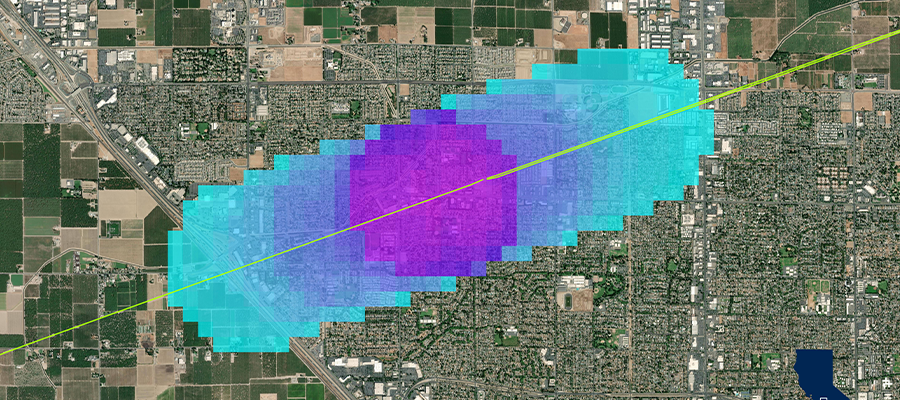
Assessing Ecological Health in San Francisco’s Utility Rights-of-Way By Joy Mellera, ROW Manager, Hetch Hetchy Water & Power; Dr. Michael Liptak, Senior Ecologist, EnviroScience; Dan Brackney, Operations Manager, ACRT Pacific Urban and rural utility rights-of-way (ROWs) represent thousands of miles of linear landscapes that extend across diverse ecosystems. Traditionally, these corridors have been managed primarily[...]
Read More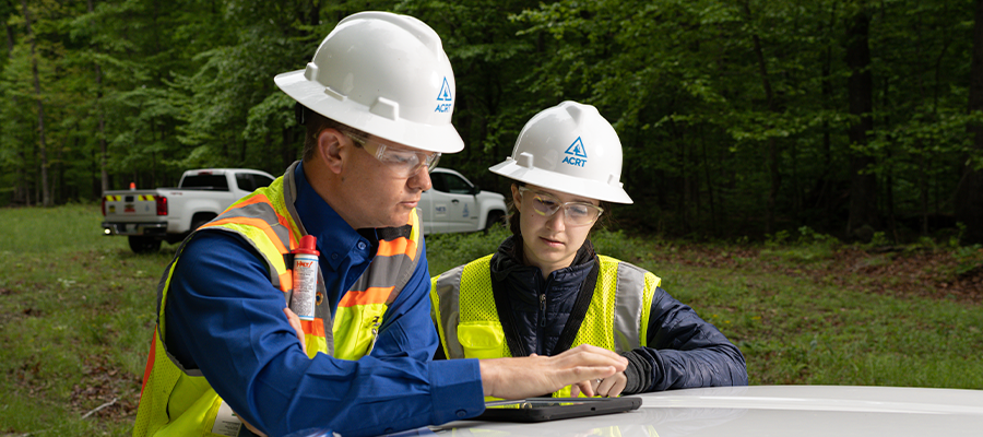
Safety Management Systems: More Than Statistics By Adrienne Jones, Safety Manager, ACRT Every organization wants employees to return home safely at the end of the day. To help achieve that goal, we measure safety performance through a variety of metrics, from incident rates, vehicle accidents, lost-time injuries, near misses, and other indicators designed to help[...]
Read More
Holistic Resource Management and Integrated Vegetation Management By Ryan Meccage, Business Development Manager, ACRT Services Utility rights-of-way (ROWs) occupy landscapes where ecological health, public safety, and operational reliability intersect. Managing vegetation in these corridors requires approaches that balance energy delivery needs with environmental stewardship, long-term sustainability, and public expectations. Two methodologies, “Holistic Management,” or Holistic[...]
Read More